To start, let me emphasize this is a serious hike with over 900m in net elevation gain and over 1200m in climbing. It took me 10.5 hours to complete it, so you must start early, and bringing a headlamp is prudent, as is buying a real map and not relying on me. The bus schedule from Tobu Nikko station is here. You really need to be on the 6:13 bus, and definitely no later than the 6:58. The 6:33 only goes to Chuzenjiko, so it is not useful for this hike. Also, note that these buses can be insanely crowded at peak season- yes, even at 6:13 am. Note that the 6:58 bus (but not the 6:13 bus) originates from JR Nikko a few minutes prior to arriving at Nikko Tobu. It's actually better to board at JR Nikko if you can because the bus will be less crowded, which can be a problem in the peak season. It takes about 1:15 hours to reach Yu-no-moto, so a 6:13 departure gets you to the trailhead before 8am and back down at 6:30pm. Obviously, the season you can do this is pretty short - late June through August maybe. September would be dark on the way down. Note that the mountain is unclimbable without equipment until late June due to snow.
I have included an annotated map below. The original (Japanese only) is here. I have also made a Google map with the trailheads marked and the course outlined. Note that the easiest ways to climb Shirane-san are not from Yu-no-moto, but the alternative trailheads I marked. These require a car. One route lies along the red trail that follows the Gunma/Tochigi border. According to my guidemaps, this appears to be a 7-8 hour hike rather than the 10-11 hours required to hike from Yu-no-moto. Shirane-san can also be approached from the west, where the Nikko Shirane Ropeway will do much of the work for you, cutting the trip down to 5-6 hours. Obviously, this is the most common route up the mountain.

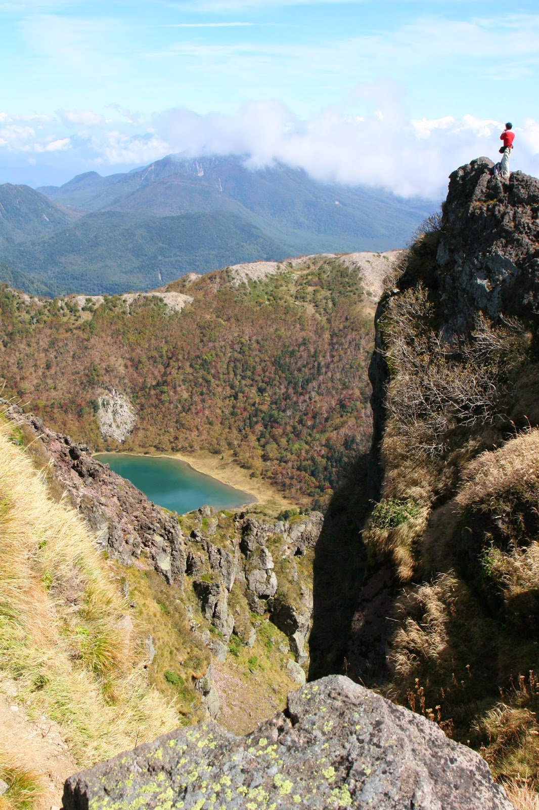
To climb Shirane-san, you first enter the ski area and climb up the trail running through the middle of it. At the top of the ski area, you will descend into the forest on the right, and then generally bear left as you climb up to Sotoyama. This is the first of two major slogs. From there, the walk to Maeshirane-san is pleasant, with great views, most notably of Shirane-san itself and Goshiki-numa.

Shirane-san and Goshiki-numa from near Maeshirane-san
From this point, I have a disagreement with Lonely Planet. They have you hike along the ridge to the left and take a secondary trail near the mountain hut down to the trail along the valley floor. However, I could not find this trail. The better way is to hike directly down from Maeshirane-san to the southeast side of the pond, and then take the trail up the valley floor from there. In other words, just below Maeshirane-san, take the right fork down to the pond rather than the left fork along the ridge, as per my map above. The actual trail up Shirane-san is about 20 minute walk up the valley from the pond, and is quite obvious. From that junction, you turn left and head up Shirane-san itself. This is your second big slog. The views are wonderful after you break the tree-line but you have an hour of solid climbing in front of you. The views from the top are fabulous.
View from near Shirane-san's summit

Mt Fuji from Shirane-san (Hint: look above the clouds)
To descend, one could reverse their course, but I recommend taking the northern trail instead. This will lead you back down to Goshiki-numa, but on the opposite side. Just before you reach the pond, there is a trail heading up Goshiki-yama. After taking a brief detour to see the pond from the opposite side, head up this trail. It's about 45 more minutes of climbing before you reach your final peak of the day. From there, just follow the signs to Yu-no-moto. There is only one substantial trail split, about 30 minutes into the descent. Head right. From there, you have another solid 1:45 to get back to civilization, mostly through rocky forest. It's a pretty tough descent, honestly, with a fair number of spots where you have to sit and slide. Eventually you will reach the valley floor, and after about ten minutes of easy walking along a small creek, will hit a small road that leads directly back to Yu-no-moto. The last buses down are at 6:24 and 7:30. Don't miss them!
Final note: The weather in the Nikko area changes very fast. Storms are common in mid-late afternoon during the summer, even on sunny days at nearby low elevations. You need to be prepared to get cold and wet and to hike in the mud, and if the weather reports are at all iffy, don't bet on the top of the mountain being kind to you.
No comments:
Post a Comment